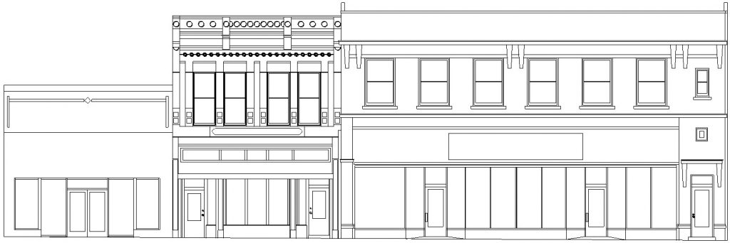
Accurate Elevation Drawings
Close-range or architectural photogrammetry can provide accurate 2D elevation (facade) drawings, and rectified (distortion free), scaled photographs.
The general definition of photogrammetry is: "the science of obtaining accurate measurements from photographs". Close-range photogrammetry is an established technique using high-resolution digital images taken from multiple camera angles, to calculate relative spatial locations of a set of points.
Photogrammetry is considered a non-contact measurement method. Therefore, is well suited for multi-story buildings, or buildings with restricted access.
A photogrammetry project is a very complete and systematic photographic recording of a building. A general rule of photogrammetry requires at least three photographs of a building facade or object from separate camera positions. Because of the extensive coverage, the field photographs may also serve as detailed historical documentation.


Delivery
Our objective is to deliver drawing files that seamlessly interface with your firm's established guidelines. The electronic file is a complete drawing, in AutoCAD format, without any requirements for third party add-on modules. Every entity within the file is drawn using conventional methods, allowing you to work with the drawing in your firm's normal fashion. You may specify virtually any aspect of the finished drawing.
AutoCAD DWG, DXF, and Adobe PDF files are provided by e-mail attachment.